Table of Contents
Deep beneath the lush surface of Vietnam’s Cu Chi Province lies a remarkable subterranean world of resilience and determination—the Cu Chi Tunnels Diagram. Stretching over 200 kilometers (124 miles), this intricately designed network of underground passages played a pivotal role in the course of the Vietnam War. Constructed by the resourceful and tenacious Vietnamese people, the tunnels served as a labyrinthine hideout, a communication hub, a logistical lifeline, and a formidable defensive stronghold against foreign aggression.
The Cu Chi Tunnels have become an iconic symbol of the Vietnam War, showcasing the ingenuity and perseverance of the Vietnamese people in the face of adversity. In this article, we will explore the Cu Chi Tunnels in detail, with a specific focus on the diagram that illustrates its complex layout and features. We will delve into the history, design, purpose, and significance of the Cu Chi Tunnels, as well as examine controversies and criticisms surrounding it. So let’s begin our journey through history, resilience, and human ingenuity as we explore the Cu Chi Tunnels.
History of Cu Chi Tunnels Diagram
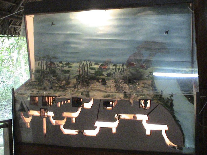
The origins of the Cu Chi Tunnels can be traced back to the early 1940s, during the French colonial era. Vietnamese villagers in the Cu Chi area began digging tunnels as a means of protection against French military operations. These early tunnels served as temporary hiding places and storage facilities for food and supplies during conflicts.
However, it was during the Vietnam War that the Cu Chi Tunnels gained widespread recognition. As the war escalated, the North Vietnamese Army and Viet Cong used the tunnels as a base of operations, allowing them to launch surprise attacks and evade American forces. The tunnels also provided shelter for civilians and served as a vital supply route for weapons, food, and medical supplies.
Despite facing constant bombing and chemical attacks, the Vietnamese people continued to expand and improve the tunnels, making them an integral part of their resistance strategy. The Cu Chi Tunnels played a crucial role in the eventual victory of North Vietnam and the reunification of the country.
Design and Construction of Cu Chi Tunnels Diagram
The Cu Chi Tunnels comprise an extensive network of underground tunnels, bunkers, living quarters, hospitals, kitchens, meeting rooms, storage areas, and secret entrances, all interconnected by narrow and winding corridors. The tunnels range in width from just 0.5 to 1 meter (1.6 to 3.3 feet) and in height from 0.8 to 1.2 meters (2.6 to 3.9 feet), creating a claustrophobic and challenging environment for those navigating its depths.
The design and construction of the Cu Chi Tunnels Diagram were a remarkable feat of engineering, considering the limited resources and tools available to the Vietnamese people. The tunnels were dug by hand using simple tools such as shovels, hoes, and picks. Bamboo was used to support the tunnel walls and ceilings, and termite mounds were utilized to create air vents and camouflage the tunnel entrances.
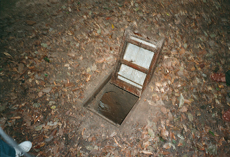
The tunnels were designed with multiple levels, with some reaching up to three stories deep. This allowed for different functions to be carried out simultaneously, such as cooking, sleeping, and storing supplies. The intricate layout of the tunnels also included trapdoors, booby traps, and false exits to confuse and deter intruders.
Layout and Features of Cu Chi Tunnels Diagram
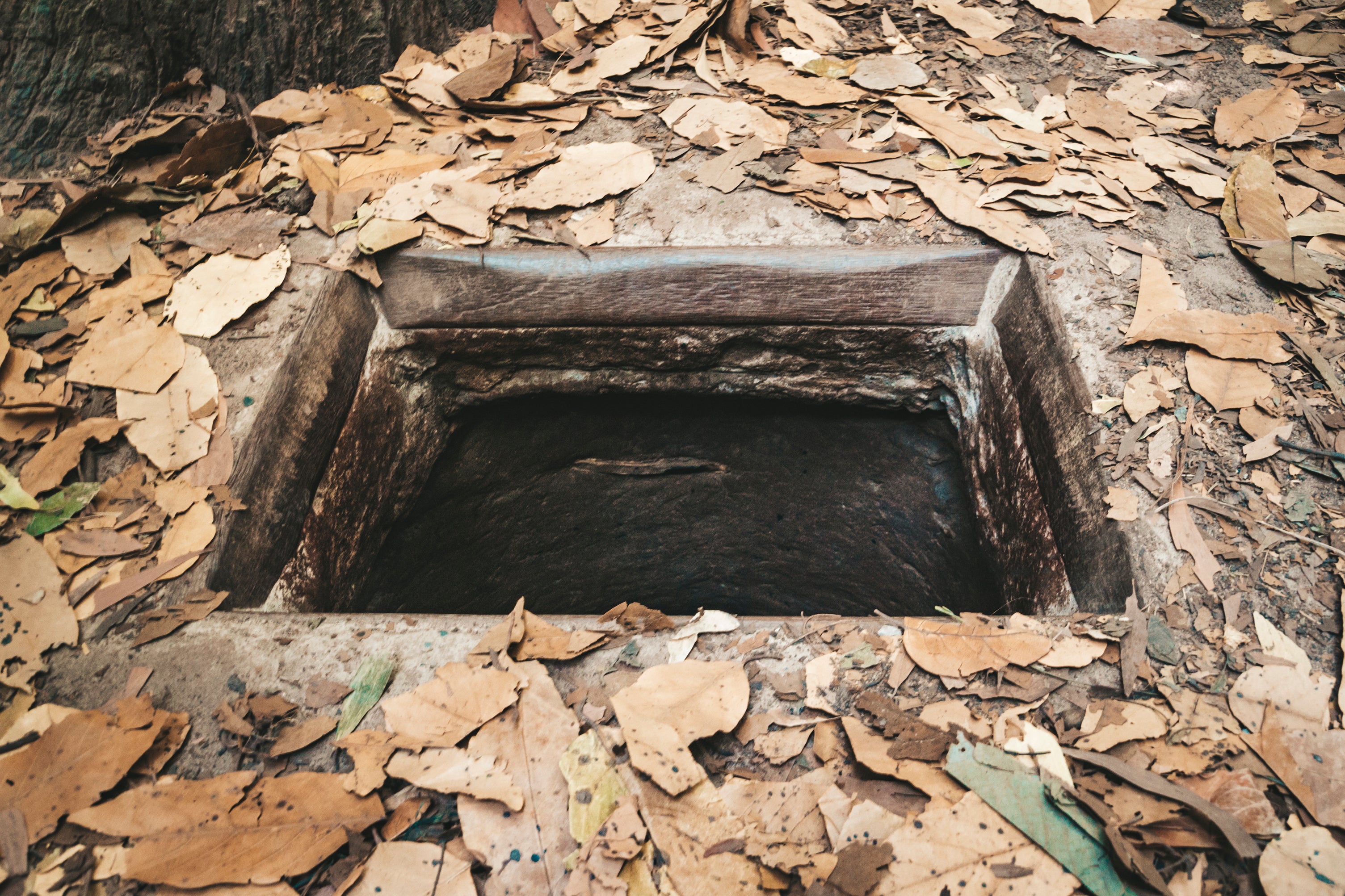
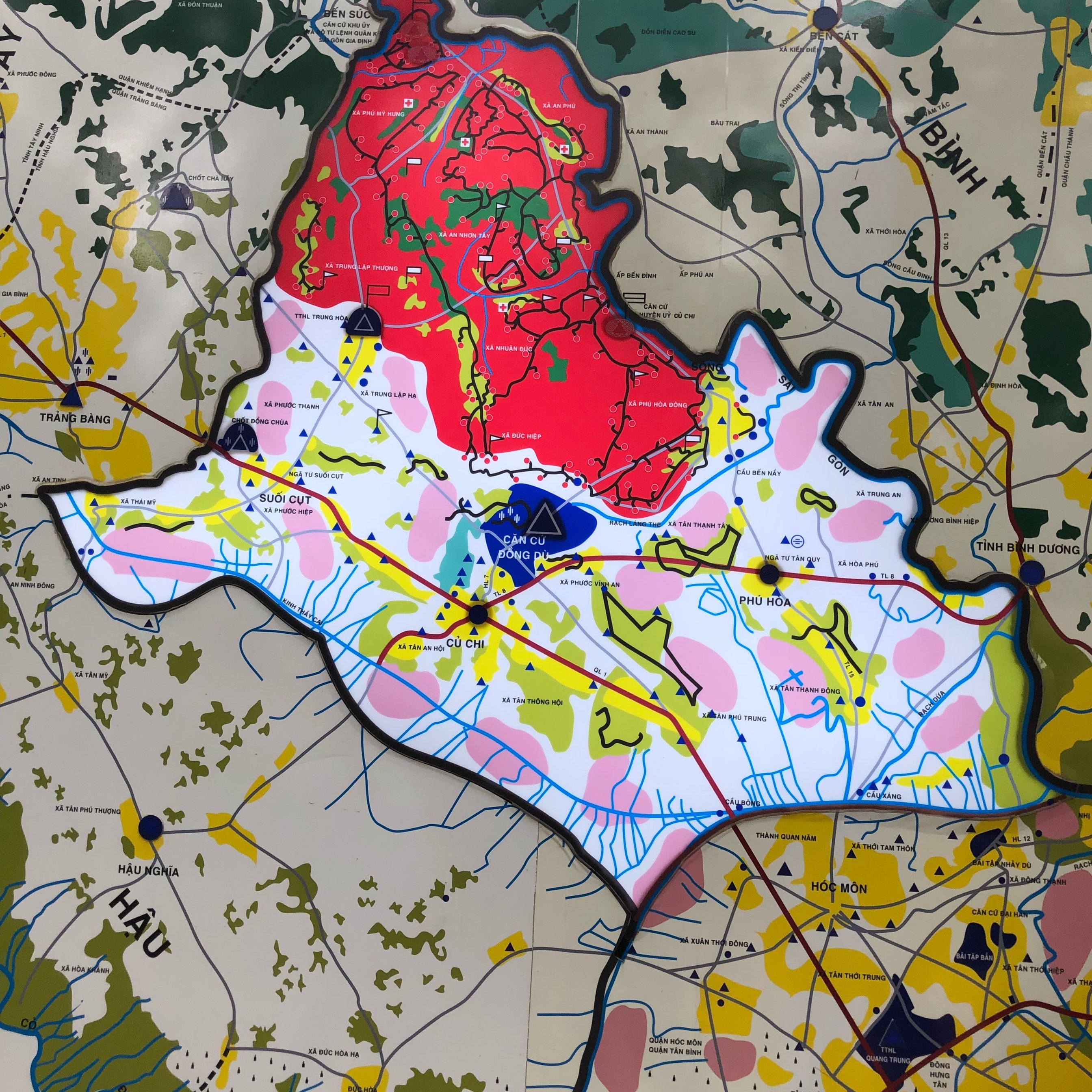
The Cu Chi Tunnels diagram provides a detailed representation of the complex network of tunnels and its various features. It is divided into three main sections: the Ben Duoc area, the Ben Dinh area, and the Iron Triangle area.
The Ben Duoc area is the largest and most well-preserved section of the tunnels, located about 60 kilometers (37 miles) from Ho Chi Minh City. It includes a museum, a shooting range, and a reconstructed tunnel system that visitors can explore. The Ben Dinh area is closer to Ho Chi Minh City and features a larger network of tunnels, including a section that has been widened for tourists.
The Iron Triangle area was the most heavily bombed and sprayed with chemicals during the war, making it the most dangerous section of the tunnels. It is now a memorial site, with only a small portion of the original tunnels remaining.
The diagram also highlights various features of the tunnels, such as the ventilation systems, living quarters, meeting rooms, and escape routes. It also shows the location of important landmarks, such as the Hoang Cam kitchen, where food was prepared for thousands of soldiers, and the Hoang Thien medical station, which provided healthcare for injured soldiers.
Purpose and Function of Cu Chi Tunnels Diagram
The Cu Chi Tunnels diagram serves multiple purposes, both during the war and in present times. During the war, the diagram was used by the Vietnamese soldiers to navigate the complex network of tunnels and plan their attacks. It also helped them identify potential weaknesses and areas for improvement.
In present times, the diagram serves as an educational tool for visitors to understand the layout and features of the tunnels. It provides a visual representation of the ingenuity and resilience of the Vietnamese people and the challenges they faced during the war. The diagram also serves as a reminder of the atrocities of war and the importance of peace and reconciliation.
Significance of Cu Chi Tunnels in Vietnam War
The Cu Chi Tunnels Diagram played a significant role in the outcome of the Vietnam War. They were crucial in the success of the North Vietnamese Army and Viet Cong’s guerrilla tactics, allowing them to launch surprise attacks and evade American forces. The tunnels also served as a symbol of the Vietnamese people’s determination and resilience in the face of foreign aggression.
The tunnels also had a psychological impact on American soldiers, who were not accustomed to fighting in such close quarters. The constant threat of booby traps and ambushes made them hesitant and cautious, giving the Vietnamese soldiers an advantage.
Furthermore, the Cu Chi Tunnels served as a vital supply route for the North Vietnamese Army and Viet Cong, allowing them to transport weapons, food, and medical supplies without being detected by American forces. This played a crucial role in sustaining their resistance efforts and ultimately led to their victory.
Comparison with Other Tunnel Systems

The Cu Chi Tunnels are often compared to other tunnel systems used in warfare, such as the tunnels used by the Viet Cong in the Mekong Delta and the Viet Minh during the First Indochina War. However, the Cu Chi Tunnels stand out for their extensive network, complex design, and strategic location near Saigon (now Ho Chi Minh City).
The Cu Chi Tunnels are also unique in their use of termite mounds for ventilation and camouflage, as well as their multiple levels and intricate layout. These features allowed for more efficient and effective operations, making the Cu Chi Tunnels a formidable stronghold against foreign aggression.
Tourism and Education at Cu Chi Tunnels

Today, the Cu Chi Tunnels Diagram have become a popular tourist destination, attracting thousands of visitors each year. Tourists can explore a section of the tunnels, visit the museum, and participate in activities such as shooting at the firing range. The Cu Chi Tunnels also serve as an educational site, providing visitors with a deeper understanding of the Vietnam War and its impact on the country.
The tourism industry surrounding the Cu Chi Tunnels has also provided economic opportunities for the local community, creating jobs and boosting the economy. It has also helped preserve the tunnels and their history for future generations.
Controversies and Criticisms of Cu Chi Tunnels

Despite its popularity as a tourist destination, the Cu Chi Tunnels have faced criticism and controversy. Some argue that the tunnels have been commercialized and turned into a theme park, diminishing their historical significance. There have also been concerns about the safety of visitors exploring the tunnels, as well as the ethical implications of shooting at the firing range.
Furthermore, there are debates surrounding the accuracy of the information presented at the museum and the portrayal of the Vietnam War from a Vietnamese perspective. These controversies highlight the challenges of preserving and presenting history in a sensitive and responsible manner.
Future of Cu Chi Tunnels Diagram
The Cu Chi Tunnels Diagram serves as an important tool for educating visitors about the complex network of tunnels and its historical significance. As tourism continues to grow, it is crucial to preserve and maintain the authenticity of the tunnels and the information presented at the site.
Efforts are also being made to expand the educational aspect of the Cu Chi Tunnels, with plans to build a research center and develop educational programs for students. This will not only provide a deeper understanding of the tunnels but also promote peace and reconciliation among future generations.
Conclusion
The Cu Chi Tunnels Diagram are a testament to the resilience, determination, and ingenuity of the Vietnamese people. They played a crucial role in the outcome of the Vietnam War and continue to serve as a symbol of the country’s struggle for independence. The Cu Chi Tunnels diagram provides a visual representation of this remarkable underground world and its historical significance. It serves as a reminder of the atrocities of war and the importance of preserving and learning from our past.