Table of Contents
Deep beneath the lush vegetation of Cu Chi Tunnels map, a district located just northwest of Ho Chi Minh City, Vietnam, lies a labyrinthine network of tunnels that played a pivotal role in the country’s struggle for independence. Known as the Cu Chi Tunnels, this intricate underground system served as a sanctuary, a strategic military base, and a testament to the indomitable spirit of the Vietnamese people. Delving into the history and significance of these tunnels offers a unique perspective on the resilience and resourcefulness of a nation fighting for its freedom.
Overview of Cu Chi Tunnels Map

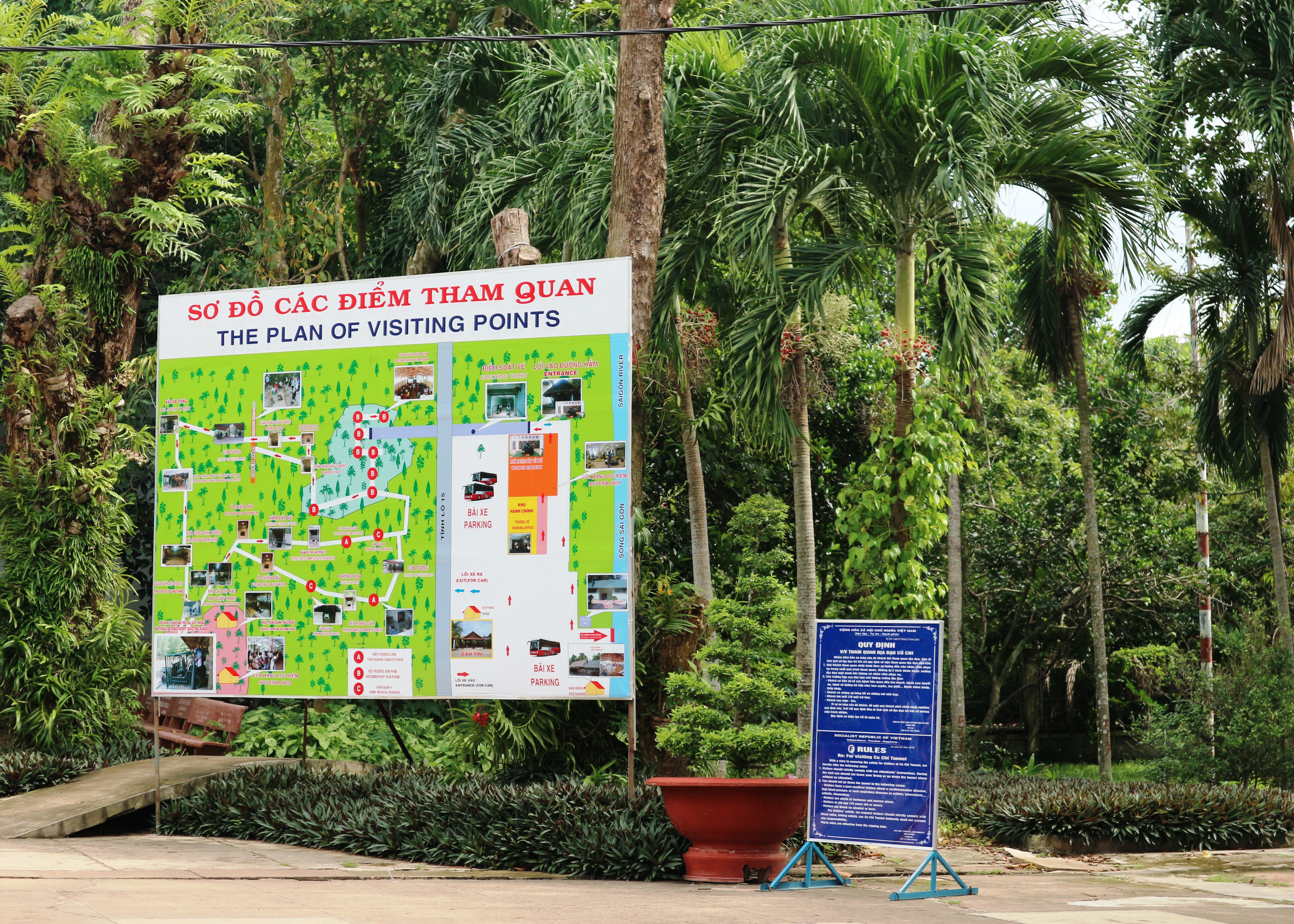
Before embarking on a journey through the Cu Chi Tunnels, it is essential to have a basic understanding of the layout and features of the tunnels. The Cu Chi Tunnels map provides a comprehensive overview of the entire tunnel system, including key landmarks and points of interest. This map is an invaluable tool for navigating the tunnels and gaining a deeper understanding of their historical significance.
The Cu Chi Tunnels map is divided into three main sections: the Ben Dinh section, the Ben Duoc section, and the connecting tunnels. Each section has its own unique features and landmarks, making it crucial to plan your route carefully. The map also includes detailed information about the length and depth of each tunnel segment, as well as the locations of entrances and exits.
To navigate the map effectively, it is essential to familiarize yourself with the symbols and legends used. For example, the red lines on the map represent the main tunnels, while the blue lines indicate secondary tunnels. The map also includes icons for important landmarks such as meeting rooms, hospitals, and weapon storage areas. By understanding these symbols, you can easily identify key locations and plan your route accordingly.
Detailed Layout of the Cu Chi Tunnels
The Cu Chi Tunnels map provides a detailed layout of the entire tunnel system, including the intricate network of tunnels, chambers, and rooms. The tunnels were designed in a zigzag pattern to confuse and slow down enemy forces, making it difficult for them to navigate through the tunnels. The map also shows the various levels of the tunnels, with some sections reaching up to three levels deep.
One of the most impressive features of the Cu Chi Tunnels is the ventilation system. The map highlights the locations of air vents and chimneys, which provided much-needed oxygen to the underground network. These vents were carefully camouflaged to blend in with the surrounding vegetation, making them nearly impossible to detect by enemy forces.
Key Landmarks on the Cu Chi Tunnels Map
The Cu Chi Tunnels map includes several key landmarks that played a crucial role in the daily lives of the Viet Cong soldiers. These landmarks served as meeting points, storage areas, and even hospitals. Some of the notable landmarks on the map include:
- Meeting Rooms: These were used for planning attacks and discussing strategies.
- Hospitals: The tunnels had makeshift hospitals where injured soldiers could receive medical treatment.
- Kitchens: The Viet Cong soldiers cooked their meals in these underground kitchens.
- Weapon Storage Areas: The tunnels also served as storage areas for weapons and ammunition.
By understanding the significance of these landmarks, visitors can gain a deeper appreciation for the resilience and resourcefulness of the Vietnamese people during the war.
Tips for Using the Cu Chi Tunnels Map
To make the most out of your visit to the Cu Chi Tunnels, here are some tips for using the map effectively:
- Familiarize yourself with the symbols and legends used on the map.
- Plan your route carefully, taking into consideration the different sections and landmarks.
- Use the map as a guide but also be open to exploring and discovering new areas.
- Take note of the locations of entrances and exits to avoid getting lost in the tunnels.
- Use the interactive features of the map (discussed in the next section) to enhance your experience.
Historical Significance of the Cu Chi Tunnels Map
The Cu Chi Tunnels map is not just a tool for navigation; it also holds significant historical value. The map serves as a reminder of the resilience and determination of the Vietnamese people during the war. It showcases the ingenuity and resourcefulness of the Viet Cong soldiers who built and maintained the tunnels, despite facing constant attacks from enemy forces.
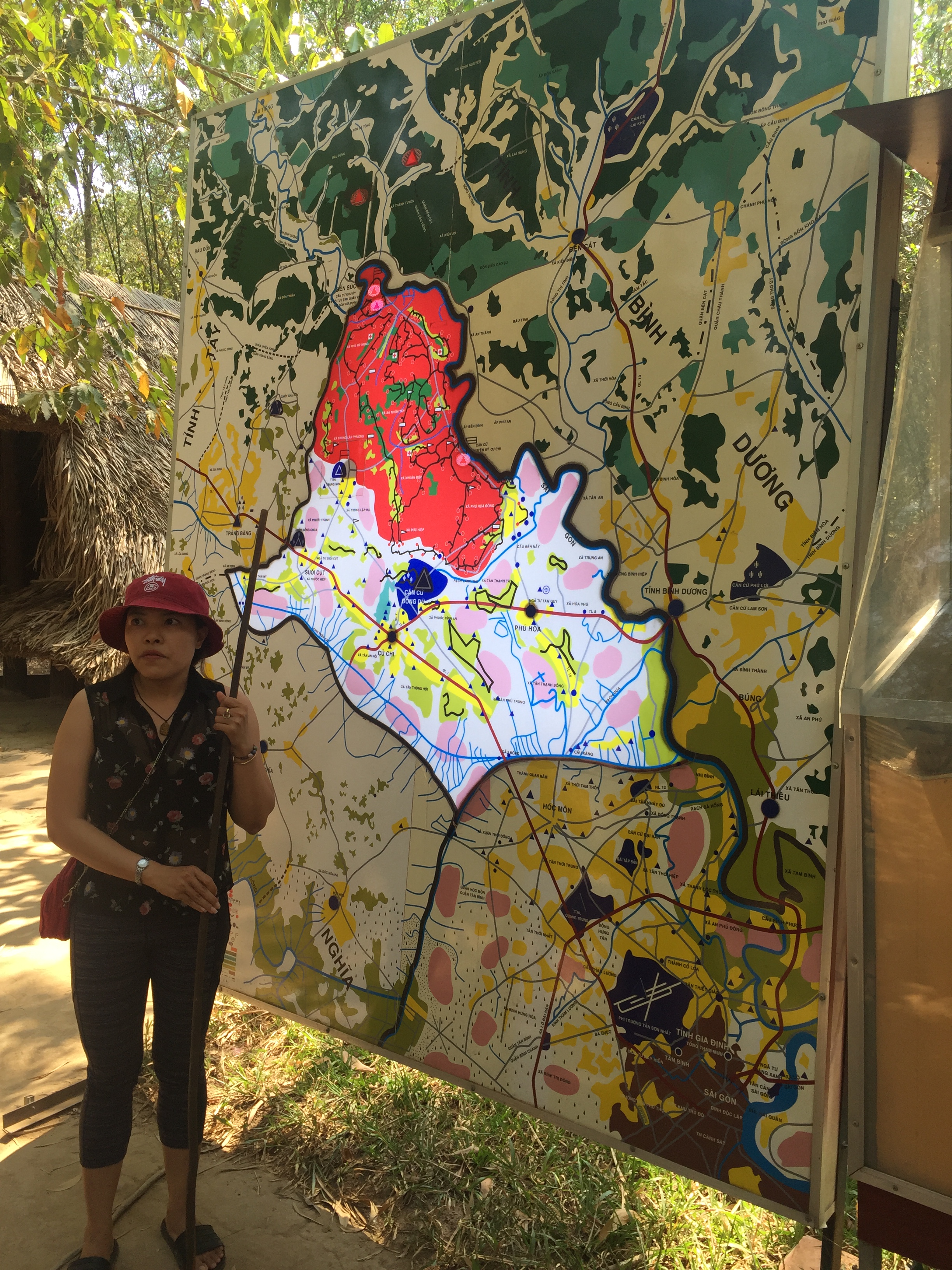
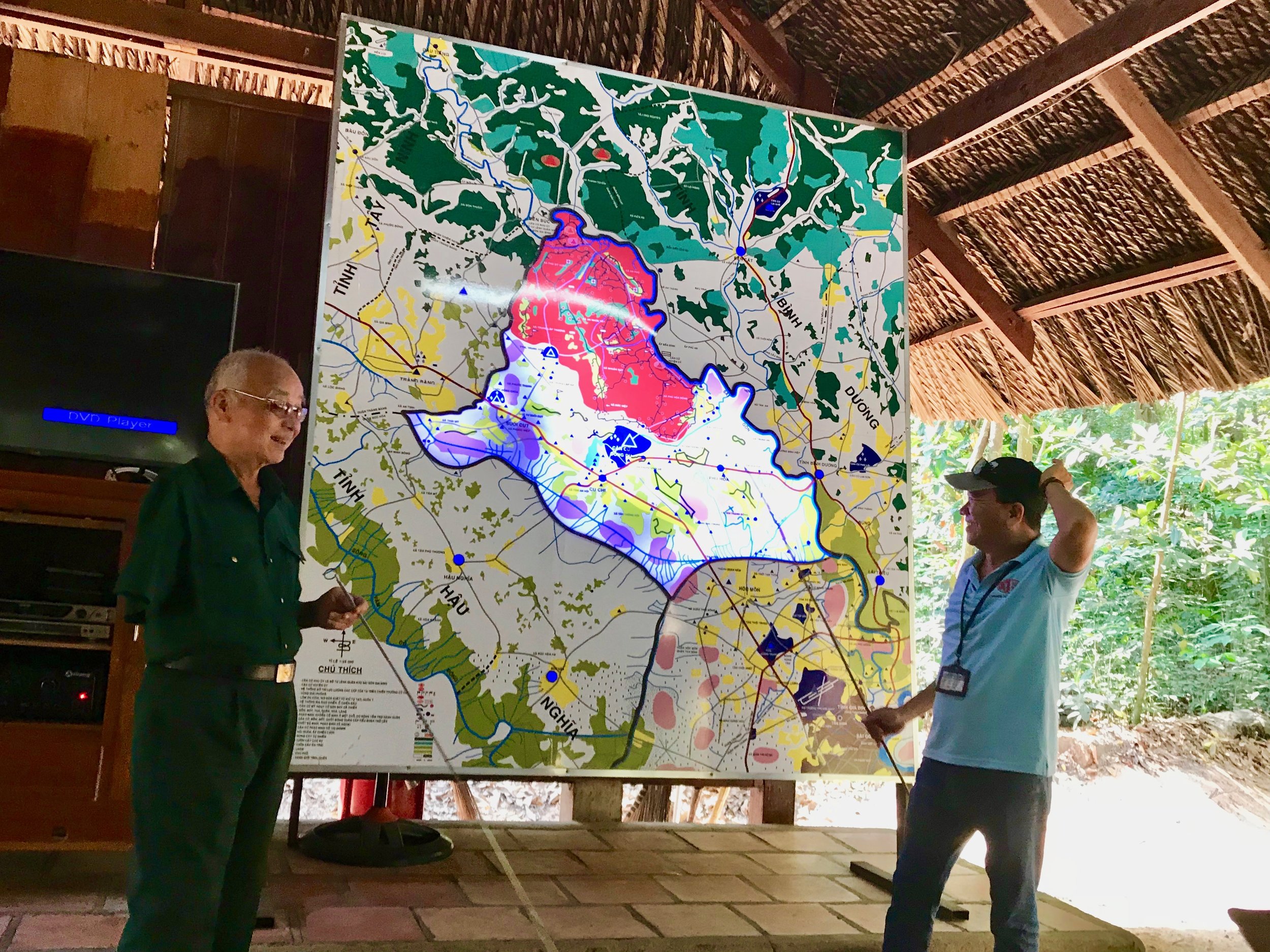
The map also highlights the strategic importance of the tunnels in the Vietnam War. The Cu Chi Tunnels served as a base for the Viet Cong, allowing them to launch surprise attacks on American and South Vietnamese troops. The tunnels also played a crucial role in the Tet Offensive, a major turning point in the war that ultimately led to the withdrawal of American troops from Vietnam.
Interactive Features of the Cu Chi Tunnels Map

In addition to providing a detailed layout of the tunnels, the Cu Chi Tunnels map also offers several interactive features to enhance visitors’ experience. These features include:
- Audio Guide: Visitors can download an audio guide app that provides additional information about the tunnels and their historical significance.
- Virtual Tour: For those unable to visit the tunnels in person, there is a virtual tour available on the official website. This tour allows users to explore the tunnels and learn about their history from the comfort of their own homes.
- 3D Model: The map also includes a 3D model of the tunnels, giving visitors a better understanding of the complex network beneath their feet.
These interactive features make the Cu Chi Tunnels map more than just a navigational tool; it becomes a comprehensive educational resource for learning about the tunnels and their historical significance.
How to Access the Cu Chi Tunnels Map
The Cu Chi Tunnels map is available for purchase at the entrance of the tunnels. It is also included in most tour packages, making it easily accessible for visitors. The map is available in multiple languages, including English, Vietnamese, French, and Chinese.
Visitors can also access the map online through the official Cu Chi Tunnels website. This allows for advanced planning and familiarization with the layout of the tunnels before visiting in person.
Common Misconceptions about the Cu Chi Tunnels Map
There are several misconceptions surrounding the Cu Chi Tunnels map, which can affect visitors’ experience. Some of these include:
- The tunnels were only used by the Viet Cong: While the Viet Cong soldiers primarily used the tunnels, they were also utilized by civilians and North Vietnamese troops.
- The tunnels were built solely for the Vietnam War: The construction of the tunnels began in the 1940s during the fight against French colonial rule. They were then expanded and improved upon during the Vietnam War.
- The tunnels were cramped and uncomfortable: While the tunnels were certainly not luxurious, they were designed to accommodate the Viet Cong soldiers’ basic needs, including sleeping quarters, kitchens, and hospitals.
By dispelling these misconceptions, visitors can gain a more accurate understanding of the Cu Chi Tunnels and their significance in Vietnam’s history.
Future Updates for the Cu Chi Tunnels Map
As technology continues to advance, there are plans to further enhance the Cu Chi Tunnels map. This includes the development of a virtual reality experience that will allow visitors to explore the tunnels in a more immersive way. There are also plans to add more interactive features to the map, such as augmented reality elements and additional historical information.
These updates will not only make the map more engaging but also provide visitors with a deeper understanding of the tunnels and their role in Vietnam’s history.

Conclusion
The Cu Chi Tunnels map is not just a navigational tool; it is a gateway to understanding the resilience, resourcefulness, and historical significance of these underground tunnels. By exploring the map and delving into its features, visitors can gain a deeper appreciation for the indomitable spirit of the Vietnamese people and the vital role the tunnels played in their fight for independence. So, whether you are planning a visit to the Cu Chi Tunnels or simply interested in learning more about this unique piece of history, the Cu Chi Tunnels map is an essential resource that will enhance your experience.